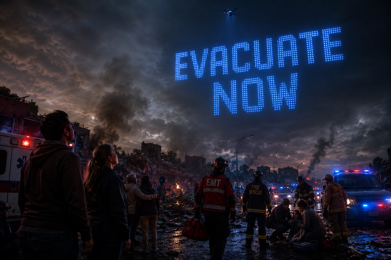
Emergency drone projecting EVACUATE NOW message above first responders and emergency vehicles at night
FLIKCOM · Critical Comms Platform

When infrastructure failscommunication becomesthe emergency

Visible up to 7 kilometers away

No App
required
No Internet
required
No Cell Service
required
No Power
required

FLIKCOM helps organizations prepare before emergencies, communicate during crises, and measure outcomes afterward.

◉ The platform · live

Critical communications for the entire emergency lifecycle

01 / Before

Prepare

Readiness assessments, training, simulations, public preparedness, and emergency planning.

  • Readiness Assessments
  • Training
  • Simulations
  • Public Preparedness
  • Emergency Planning
02 / During

Communicate

Drone messaging, public guidance, emergency coordination, and operational support.

  • Drone Messaging
  • Public Guidance
  • Emergency Coordination
  • Operational Support
  • Situational Awareness
03 / After

Measure

Analytics, movement intelligence, stakeholder reporting, and future readiness.

  • Analytics
  • Movement Intelligence
  • Stakeholder Reporting
  • Lessons Learned
  • Future Readiness
Communicate

Messages visible across the entire sky

Drone-based communications deliver clear guidance across large geographic areas — visible up to 7 km away, without depending on systems that disasters destroy first.
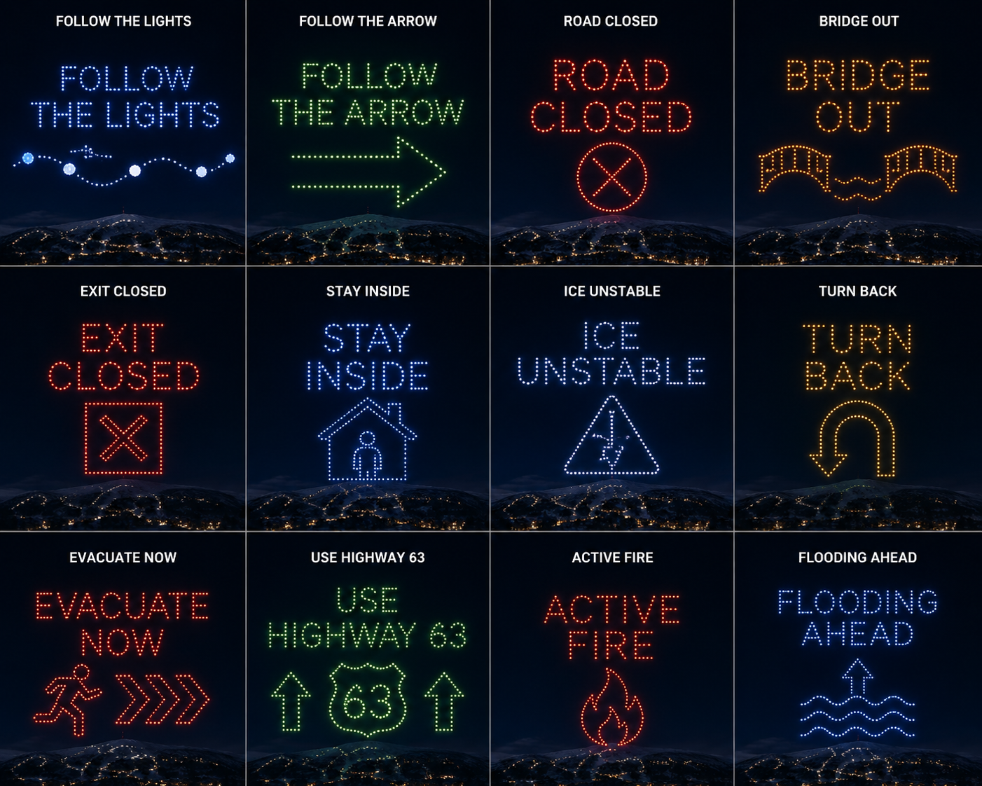
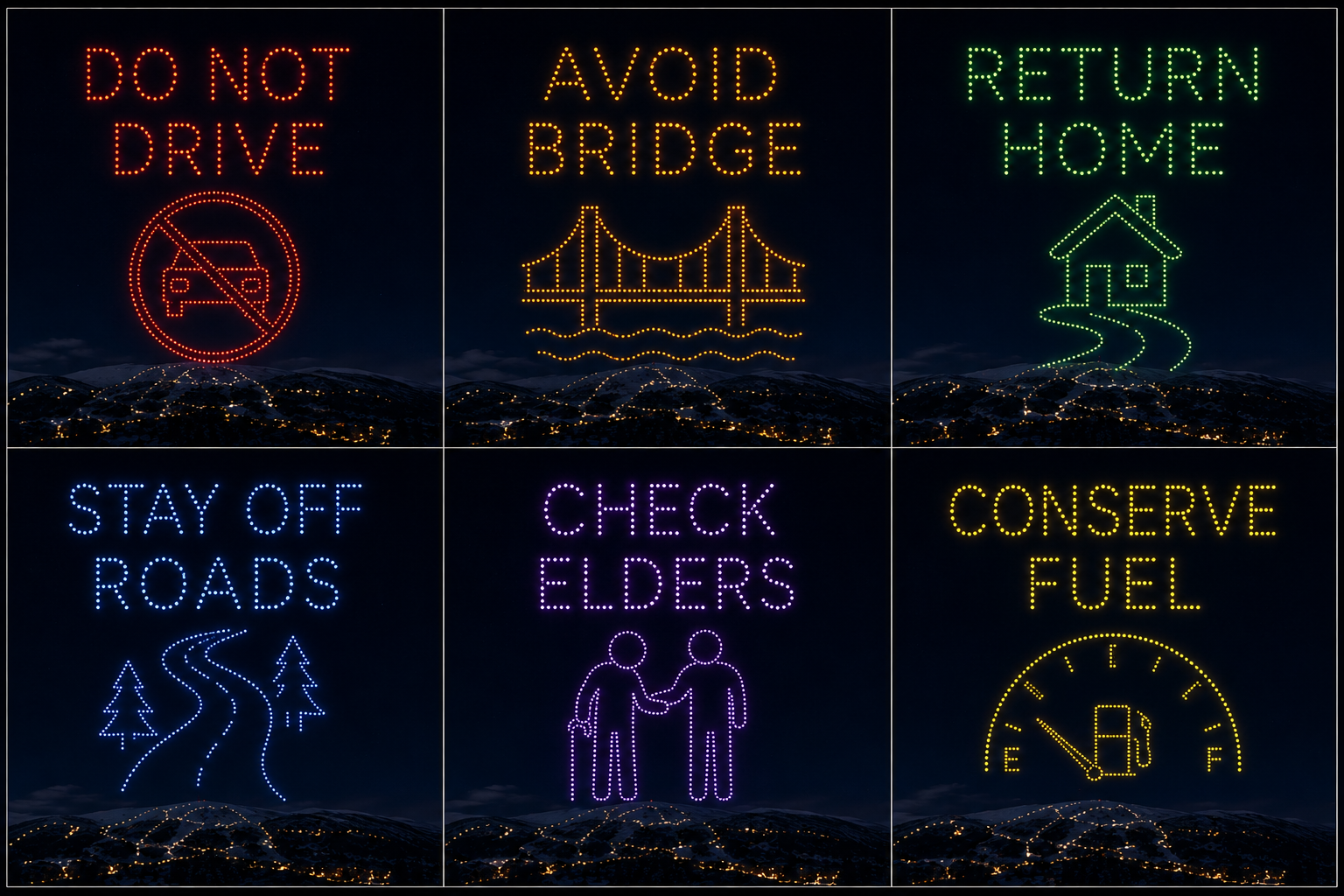
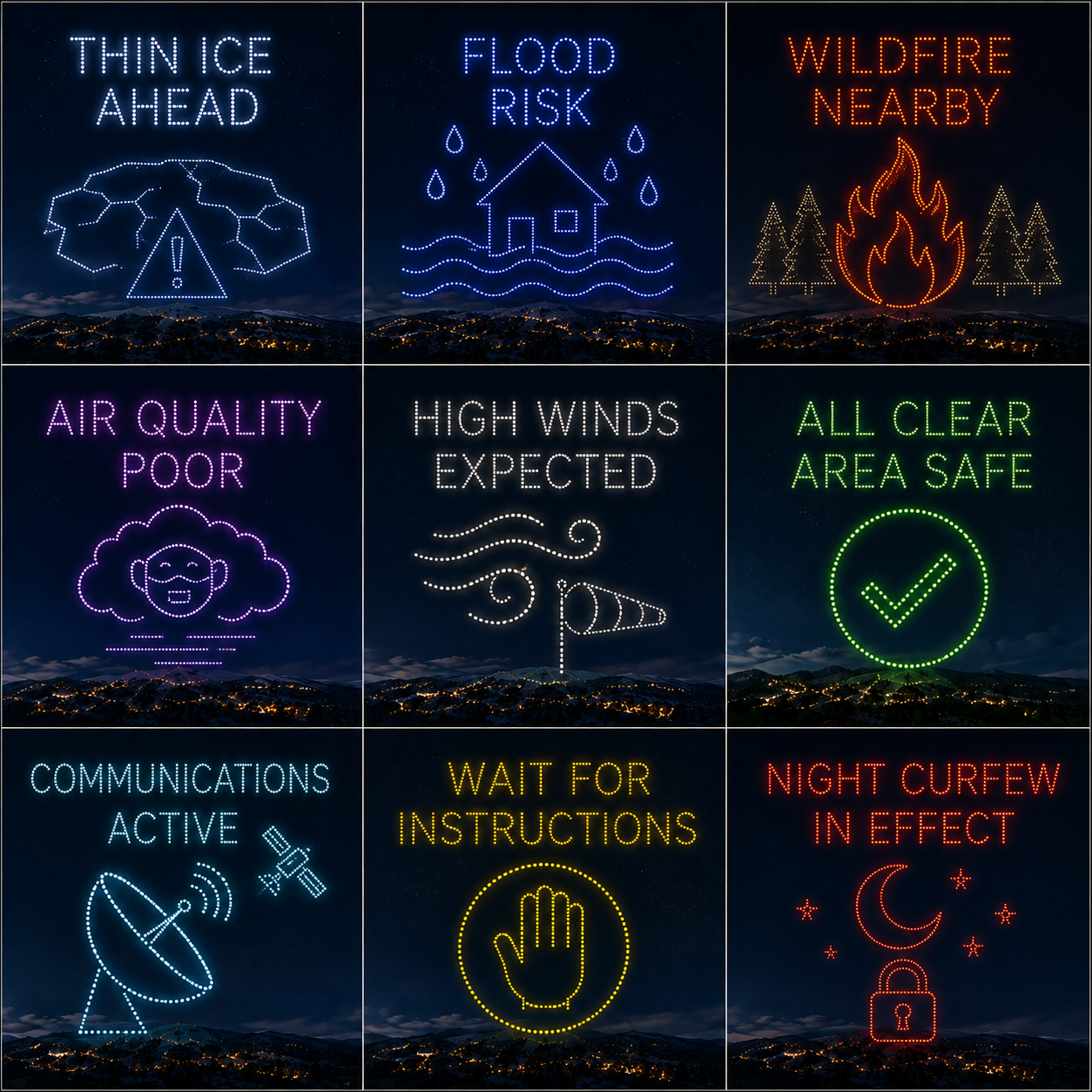
Evacuate NowShelter This WayFree Water AvailableMedical SupportRoad Closure AheadScan For Live Updates
Grid of FLIKCOM emergency drone sky messages
FLIKCOM drone sky alerts
FLIKCOM emergency drone messaging
⚠ Why the old way fails

The problem isn't sending information
It's reaching people when infrastructure fails

Capability
Traditional Comms

TV · RADIO · SMS · APPS · INTERNET

FLIKCOM

SKY · VISIBLE · RESILIENT

Works without power
Works without cell service
Works without internet
No app or device required
Visible up to 7 km
Operates during blackouts
Reaches people on the move
Measurable engagement data
Outcome
Communication Breakdown
Operational Intelligence
⬢ Who we serve

Built for the organizations responsible when it matters most

Government

Public safety, disaster response, civic coordination.

Emergency Management

Preparedness, response, operational visibility.

Police

Public safety communications and incident support.

Fire

Evacuation coordination and public guidance.

Airports

Passenger communications and emergency response.

NGOs

Humanitarian aid coordination and impact reporting.

◉ Powered by HOVR IQ

The intelligence layer behind FLIKCOM

Every drone deployment generates operational data. HOVR IQ turns that signal into decisions — measuring engagement, movement, and response in real time.
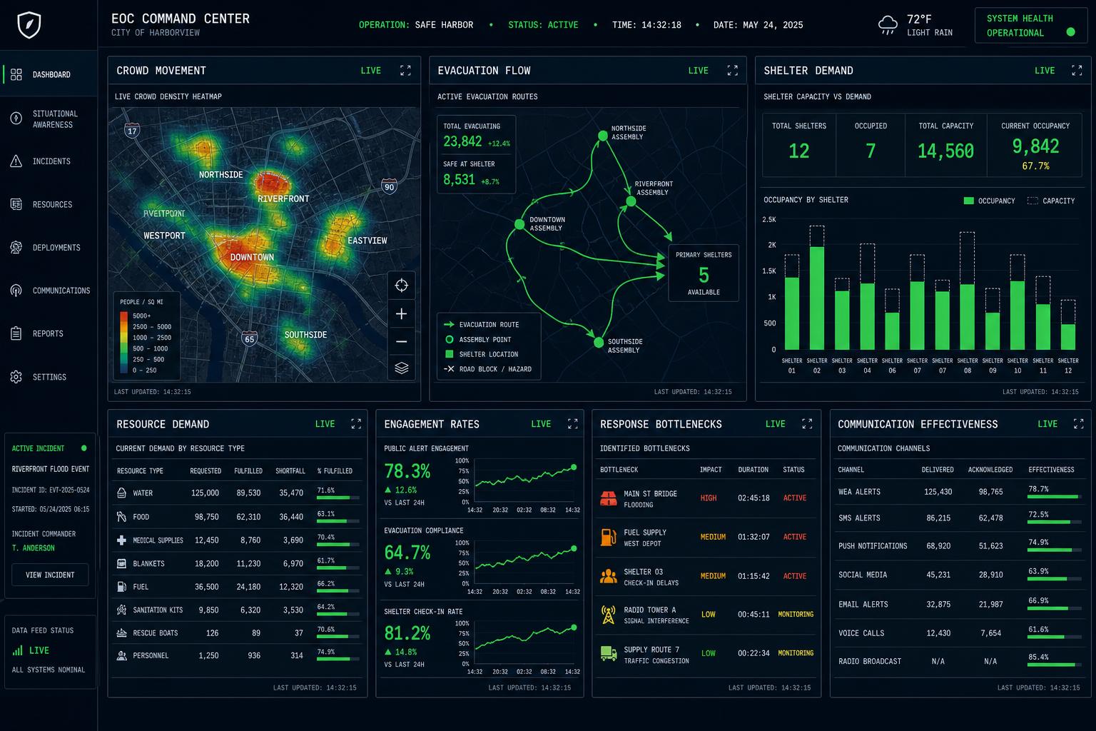
HOVR IQ command center dashboard showing live evacuation routes, crowd heatmaps, drone fleet status, and engagement analytics
Crowd movement
Evacuation flow
Shelter demand
Communication effectiveness
Engagement rates
Resource demand
Response bottlenecks
Consulting

Build the capability before you need it

Owning drones is not the same as having a drone program.

We help organizations evaluate vendors, define requirements, develop SOPs, and integrate drone communications into Emergency Operations Centers and Incident Command Systems.

Readiness Assessments

  • Capability audits
  • Gap analysis
  • Vendor evaluation

Drone Program Development

  • SOP development
  • Activation protocols
  • Inter-agency coordination

Training & Simulations

  • Live exercises
  • Tabletops
  • Operator training

Procurement Support

  • Vendor selection
  • Platform comparison
  • Operational integration

The next emergency is not a possibility
It's an inevitability

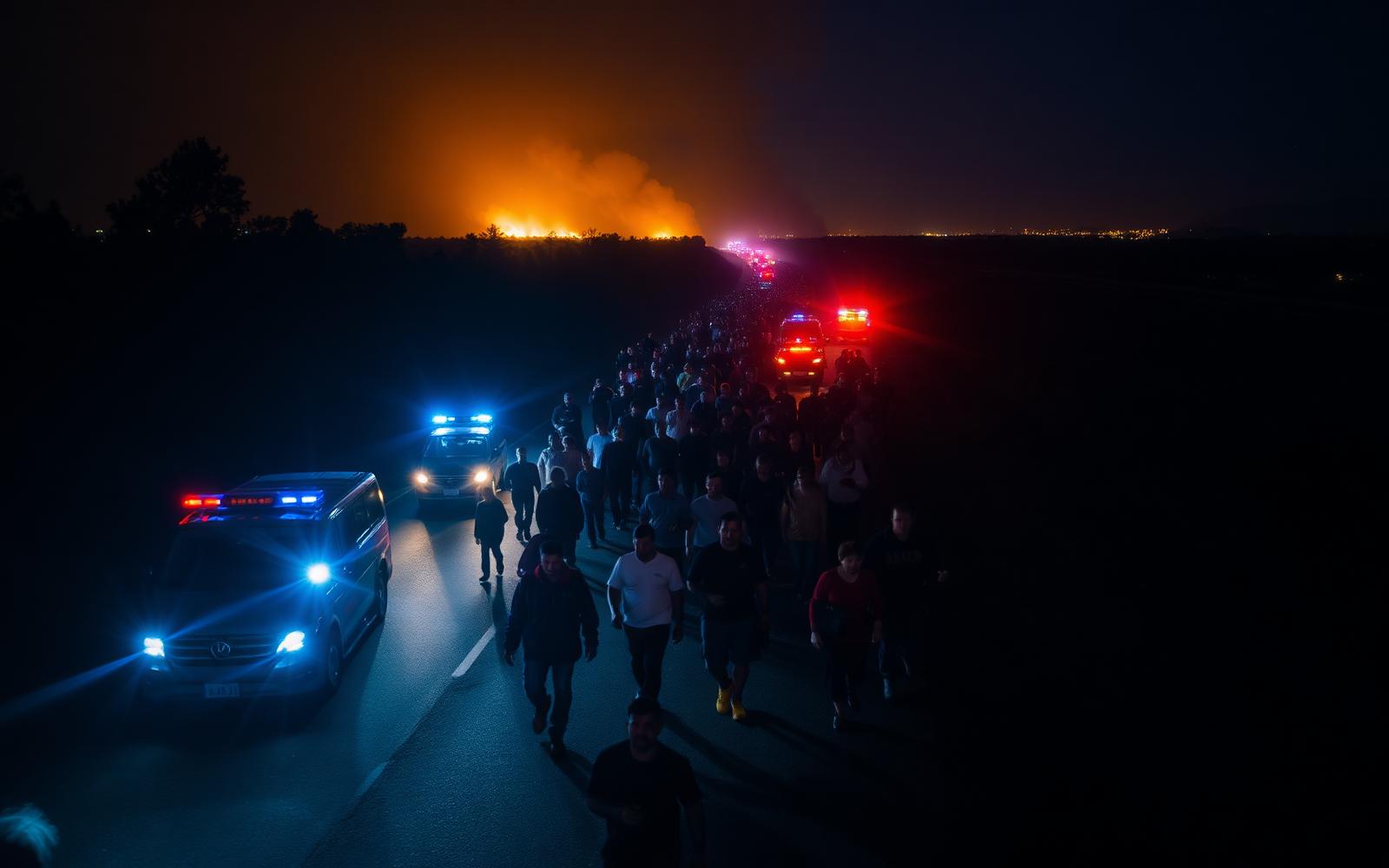
The question is not whether your organization will face disruption. The question is whether you'll be ready when communication becomes the emergency.

Prepare
Communicate
Coordinate
Measure